Atlas
Karte von Europa aus Stielers Handatlas, um 1889 : Europa. - 1:15 000 000. - Gotha : Perthes , [ca. 1889]. - 1 Kt. ; mehrfarb. , 40 x 33 cm. +++ Mit 3 Nebenkt. u.d.T.: Strasse von Gibraltar; Gibraltar; Völker von Europa // Karte No. 8 aus: Adolf Stieler's Handatlas über alle Theile der Erde und über das Weltgebäude. - Gotha : Perthes , [ca. 1889]. - 95 Bl., 198 S. : überw. Kt.
Europa. - 1:15 000 000. - Gotha : Perthes , [ca. 1889]. - 1 Kt. ; mehrfarb. , 40 x 33 cm. +++ Mit 3 Nebenkt. u.d.T.: Strasse von Gibraltar; Gibraltar; Völker von Europa // Karte No. 8 aus: Adolf Stieler's Handatlas über alle Theile der Erde und über das Weltgebäude. - Gotha : Perthes , [ca. 1889]. - 95 Bl., 198 S. : überw. Kt.
Datensatz in color
- Location
-
Sächsische Landesbibliothek - Staats- und Universitätsbibliothek Dresden (SLUB), Kartensammlung
- Inventory number
-
SLUB/KS RB 10226.9 S855 A2
- Other number(s)
-
df_dk_0009954 (Aufnahmenummer)
90080918 (Dokumentennummer)
- Classification
-
Druckgrafik (Gattung)
- Subject (where)
-
Europa (Dargestellter Ort)
- Subject (event)
-
Herstellung
- (who)
-
Stieler, Adolf (Kartograf)
- (when)
-
um 1889
- (description)
-
Erschaffung abgebildetes Objekt
Kupferstich (Material/Technik)
- Event
-
Fotografische Aufnahme
- (when)
-
2016
- Rights
-
Bitte beachten Sie die Nutzungsbedingungen der Deutschen Fotothek.
- Last update
-
05.03.2025, 4:19 PM CET
Data provider
This object is provided by:
Deutsche Fotothek. If you have any questions about the object, please contact the data provider.
Deutsche Fotothek. If you have any questions about the object, please contact the data provider.
Object type
- Atlas
Associated
- Stieler, Adolf (Kartograf)
Time of origin
- 2016
- um 1889
Other Objects (12)

Stielers Hand-Atlas
Stielers Hand-Atlas
Stielers Hand-Atlas
Stielers Hand-Atlas
Stielers Hand-Atlas
Hand-Atlas, [...]. Namenverzeichnis zu Stielers Hand-Atlas
Stieler's Handatlas. Nr. 68 - Afrika
Stieler's Handatlas. Nr. 58 - Asia
Stielers Hand-Atlas (9. Auflage)
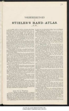
Vorbemerkungen zu Stieler's Hand-Atlas
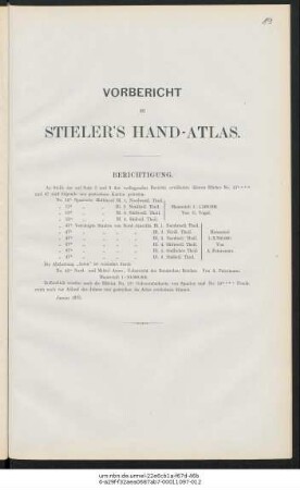
Vorbericht zu Stieler's Hand-Atlas
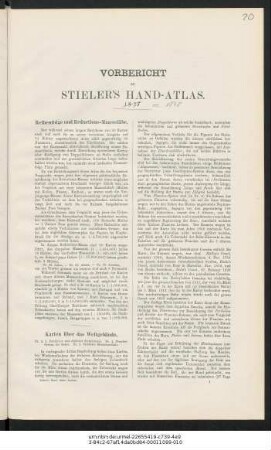
Vorbericht zu Stieler's Hand-Atlas
Stielers Hand-Atlas
Stielers Hand-Atlas
Stielers Hand-Atlas
Stielers Hand-Atlas
Stielers Hand-Atlas
Hand-Atlas, [...]. Namenverzeichnis zu Stielers Hand-Atlas
Stieler's Handatlas. Nr. 68 - Afrika
Stieler's Handatlas. Nr. 58 - Asia
Stielers Hand-Atlas (9. Auflage)
Vorbemerkungen zu Stieler's Hand-Atlas
Vorbericht zu Stieler's Hand-Atlas
Vorbericht zu Stieler's Hand-Atlas
Stielers Hand-Atlas
Stielers Hand-Atlas
Stielers Hand-Atlas
Stielers Hand-Atlas
Stielers Hand-Atlas
Hand-Atlas, [...]. Namenverzeichnis zu Stielers Hand-Atlas
Stieler's Handatlas. Nr. 68 - Afrika
Stieler's Handatlas. Nr. 58 - Asia
Stielers Hand-Atlas (9. Auflage)
Vorbemerkungen zu Stieler's Hand-Atlas
Vorbericht zu Stieler's Hand-Atlas