topographische Karten
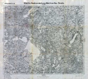
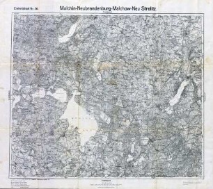
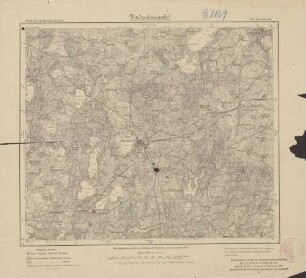
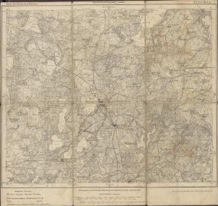
Karte des Gebietes von Malchin, Neubrandenburg, Malchow und Neu-Strelitz
- Alternative title
-
Reichskarte Einheitsblatt 36
- Location
-
Deutsches Historisches Museum, Berlin
- Inventory number
-
Do 83/25I
- Measurements
-
Höhe x Breite: 65,5 x 73,5 cm
- Material/Technique
-
Papier, gedruckt
- Classification
-
Karten, Pläne, Risse (Gattung)
- Subject (what)
-
Topographie
Deutschland
- Event
-
Herstellung
- (who)
-
Herausgeber: Verlag des Reichsamts für Landesaufnahme
- (where)
-
Berlin, Deutschland [historisch: Deutsches Reich]
- (when)
-
1921
- Rights
-
Deutsches Historisches Museum
- Last update
-
24.03.2023, 9:29 AM CET
Data provider
This object is provided by:
Stiftung Deutsches Historisches Museum. If you have any questions about the object, please contact the data provider.
Stiftung Deutsches Historisches Museum. If you have any questions about the object, please contact the data provider.
Object type
- topographische Karten
Associated
- Herausgeber: Verlag des Reichsamts für Landesaufnahme
Time of origin
- 1921
Other Objects (12)
Reichskarte: Einheitsblatt 36 Malchin-Neubrandenburg-Malchow-Neu Strelitz
Reichskarte: Einheitsblatt 36 Malchin-Neubrandenburg-Malchow-Neu Strelitz
![[Neu-Strelitz]](https://iiif.deutsche-digitale-bibliothek.de/image/2/f5ee3741-cbae-4faa-942a-463044c24e88/full/!306,450/0/default.jpg)
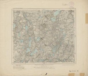
[Neu-Strelitz]
Neu-Strelitz.

Neustrelitz.- Mecklenburg-Strelitz
Neustrelitz, Mecklenburg-Strelitz
184. Neu-Strelitz
184. Neu-Strelitz
184. Neu-Strelitz
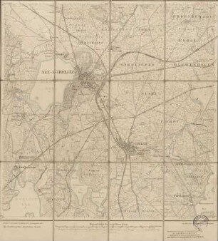
2644 Neu-Strelitz
Protokolle und Berichte der KV FDGB.- Bez. Neubrandenburg. Altentreptow, Anklam, Demmin, Malchin, Neubrandenburg, Neustrelitz
Ratsapotheke in Strelitz-Alt (Neustrelitz-Strelitz)
Reichskarte: Einheitsblatt 36 Malchin-Neubrandenburg-Malchow-Neu Strelitz
Reichskarte: Einheitsblatt 36 Malchin-Neubrandenburg-Malchow-Neu Strelitz
[Neu-Strelitz]
Neu-Strelitz.
Neustrelitz.- Mecklenburg-Strelitz
Neustrelitz, Mecklenburg-Strelitz
184. Neu-Strelitz
184. Neu-Strelitz
184. Neu-Strelitz
2644 Neu-Strelitz
Protokolle und Berichte der KV FDGB.- Bez. Neubrandenburg. Altentreptow, Anklam, Demmin, Malchin, Neubrandenburg, Neustrelitz