Luftbildpläne
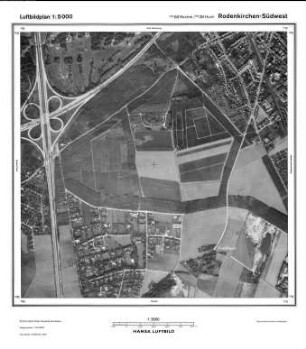
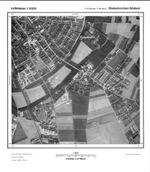
Rodenkirchen Südwest, Gauß-Krüger-Koordinaten: Rechtswert: 2568, Hochwert: 5638
- title of record
-
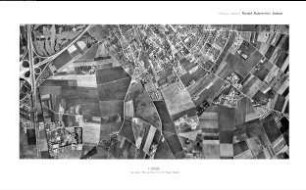
Giesdorf, Gauß-Krüger-Koordinaten: Rechtswert: 2568, Hochwert: 5636
- Dimensions
-
Maßstab: 1:10.000
- Further information
-
Land: NRW
- Context
-
Hansa Luftbild: Luftbildpläne 1:10.000 >> 2. Rechtswerte beginnend mit 25 >> Giesdorf, Gauß-Krüger-Koordinaten: Rechtswert: 2568, Hochwert: 5636
- Holding
-
RW 0434 Hansa Luftbild: Luftbildpläne 1:10.000
- Creator
-
Hersteller: Hansa Luftbild
- Provenance
-
Hansa Luftbild
- Date of creation
-
1968
- Other object pages
- Delivered via
- Last update
-
07.03.2025, 10:32 AM CET
Data provider
This object is provided by:
Landesarchiv Nordrhein-Westfalen. Abteilung Rheinland. If you have any questions about the object, please contact the data provider.
Landesarchiv Nordrhein-Westfalen. Abteilung Rheinland. If you have any questions about the object, please contact the data provider.
Object type
- Luftbildpläne
Associated
- Hersteller: Hansa Luftbild
- Hansa Luftbild
Time of origin
- 1968
Other Objects (12)
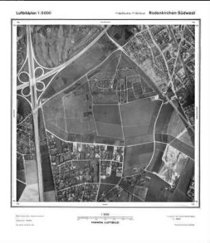
Rodenkirchen Südwest, Gauß-Krüger-Koordinaten: Rechtswert: 2568, Hochwert: 5638

Rodenkirchen Südwest, Gauß-Krüger-Koordinaten: Rechtswert: 2568, Hochwert: 5638
Rodenkirchen Südwest, Gauß-Krüger-Koordinaten: Rechtswert: 2568, Hochwert: 5638
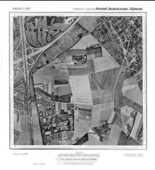
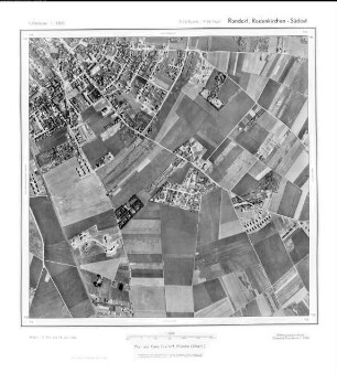
Rondorf, Rodenkirchen Südwest, Gauß-Krüger-Koordinaten: Rechtswert: 2568, Hochwert: 5638
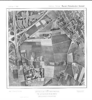
Rondorf Rodenkirchen Südwest, Gauß-Krüger-Koordinaten: Rechtswert: 2568, Hochwert: 5638
Rondorf, Rodenkirchen Südwest, Gauß-Krüger-Koordinaten: Rechtswert: 2568, Hochwert: 5638
Rondorf Rodenkirchen SW, Gauß-Krüger-Koordinaten: Rechtswert: 2568, Hochwert: 5638
Rodenkirchen, Gauß-Krüger-Koordinaten: Rechtswert: 2570, Hochwert: 5638
Rodenkirchen Südost, Gauß-Krüger-Koordinaten: Rechtswert: 2570, Hochwert: 5638
Rodenkirchen Südost, Gauß-Krüger-Koordinaten: Rechtswert: 2570, Hochwert: 5638
Rondorf Rodenkirchen Südost, Gauß-Krüger-Koordinaten: Rechtswert: 2570, Hochwert: 5638
Rondorf, Rodenkirchen Südost, Gauß-Krüger-Koordinaten: Rechtswert: 2570, Hochwert: 5638
Rodenkirchen Südwest, Gauß-Krüger-Koordinaten: Rechtswert: 2568, Hochwert: 5638
Rodenkirchen Südwest, Gauß-Krüger-Koordinaten: Rechtswert: 2568, Hochwert: 5638
Rodenkirchen Südwest, Gauß-Krüger-Koordinaten: Rechtswert: 2568, Hochwert: 5638
Rondorf, Rodenkirchen Südwest, Gauß-Krüger-Koordinaten: Rechtswert: 2568, Hochwert: 5638
Rondorf Rodenkirchen Südwest, Gauß-Krüger-Koordinaten: Rechtswert: 2568, Hochwert: 5638
Rondorf, Rodenkirchen Südwest, Gauß-Krüger-Koordinaten: Rechtswert: 2568, Hochwert: 5638
Rondorf Rodenkirchen SW, Gauß-Krüger-Koordinaten: Rechtswert: 2568, Hochwert: 5638
Rodenkirchen, Gauß-Krüger-Koordinaten: Rechtswert: 2570, Hochwert: 5638
Rodenkirchen Südost, Gauß-Krüger-Koordinaten: Rechtswert: 2570, Hochwert: 5638
Rodenkirchen Südost, Gauß-Krüger-Koordinaten: Rechtswert: 2570, Hochwert: 5638
Rondorf Rodenkirchen Südost, Gauß-Krüger-Koordinaten: Rechtswert: 2570, Hochwert: 5638