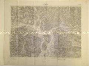
Geografische Karte
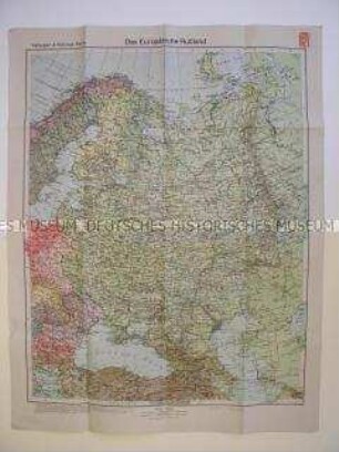
Geografische Karte des europäischen Teils der UdSSR mit den Ländern des Baltikums und Skandinaviens
- Alternative title
-
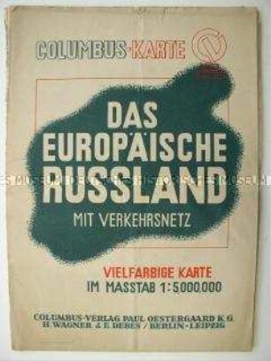
Das europäische Russland
- Location
-
Deutsches Historisches Museum, Berlin
- Inventory number
-
Do 70/658.1
- Measurements
-
Höhe x Breite: 87,2 x 63 cm (aufgeschlagen)
- Material/Technique
-
Papier, gedruckt
- Classification
-
Kartografie (Gattung)
- Subject (what)
-
Geographie
- Event
-
Herstellung
- (who)
-
Herausgeber: Columbus-Verlag Paul Oestergaard K.G.
- (where)
-
Berlin Leipzig, Deutschland [historisch: Deutsches Reich]
- (when)
-
1943
- Rights
-
Deutsches Historisches Museum
- Last update
-
24.03.2023, 9:31 AM CET
Data provider
This object is provided by:
Stiftung Deutsches Historisches Museum. If you have any questions about the object, please contact the data provider.
Stiftung Deutsches Historisches Museum. If you have any questions about the object, please contact the data provider.
Object type
- Geografische Karte
Associated
- Herausgeber: Columbus-Verlag Paul Oestergaard K.G.
Time of origin
- 1943
Other Objects (12)
Geografische Karte des europäischen Teils der UdSSR mit den Ländern des Baltikums und Skandinaviens
Geografische Karte des europäischen Teils der UdSSR

Geografische Karte der Gegend um Rositten in der UdSSR
Geografische Karte der Gegend um Pskow in der UdSSR
Geografische Karte des Mittelmeerraumes
Geografische Karte des Saarlandes
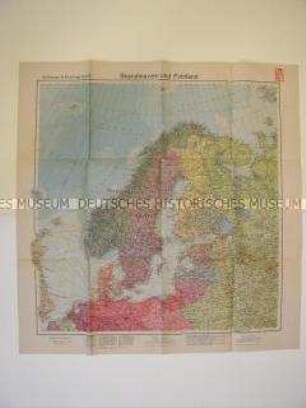
Geografische Karte von Nordeuropa
Geografische Karte des Argonnenwaldes
Geografische Karte von Schleswig-Holstein
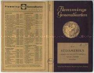
Geografische Karte von Südamerika - Nachlass
Geografische Karte der estnischen Ostseeküste
Geografische Karte eines Alpen-Abschnittes
Geografische Karte des europäischen Teils der UdSSR mit den Ländern des Baltikums und Skandinaviens
Geografische Karte des europäischen Teils der UdSSR
Geografische Karte der Gegend um Rositten in der UdSSR
Geografische Karte der Gegend um Pskow in der UdSSR
Geografische Karte des Mittelmeerraumes
Geografische Karte des Saarlandes
Geografische Karte von Nordeuropa
Geografische Karte des Argonnenwaldes
Geografische Karte von Schleswig-Holstein
Geografische Karte von Südamerika - Nachlass
Geografische Karte der estnischen Ostseeküste