Karten / Pläne
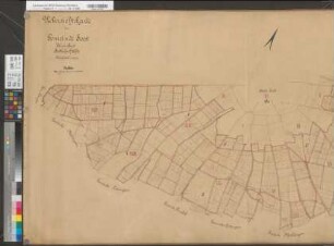
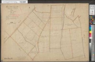
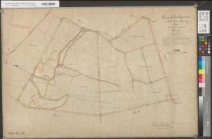
Soest (Soest), Separation Soest, Übersichtskarte nördliche Hälfte
- Reference number
-
W 051, 41585
- Dimensions
-
Höhe: 87, Breite: 152, Maßstab: 1:5000
- Context
-
Karten A (Allgemein) >> 11. Landesamt für Agrarordnung >> 11.1789. Soest (Soest), Separation Soest
- Holding
-
W 051 Karten A (Allgemein)
- Date of creation
-
(1887)
- Other object pages
- Delivered via
- Last update
-
07.03.2025, 10:40 AM CET
Data provider
This object is provided by:
Landesarchiv Nordrhein-Westfalen. Abteilung Westfalen. If you have any questions about the object, please contact the data provider.
Landesarchiv Nordrhein-Westfalen. Abteilung Westfalen. If you have any questions about the object, please contact the data provider.
Object type
- Karten / Pläne
Time of origin
- (1887)
Other Objects (12)
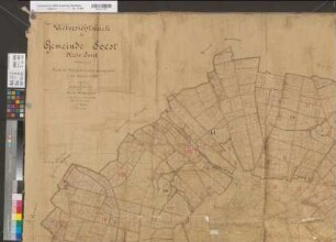
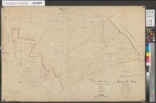
Soest (Soest), Separation Soest, Übersichtskarte südliche Hälfte
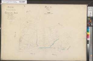
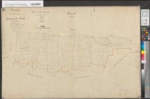
Soest (Soest), Separation Soest, Übersichtskarte

Soest (Soest), Separation Soest, Übersichtskarte Stadt Soest
Soest (Soest), Separation Soest, Übersichtskarte Stadt Soest

Soest (Soest), Separation Soest, Übersichtskarte Stadt Soest

Soest (Soest), Separation Soest, Übersichtskarte Stadt Soest
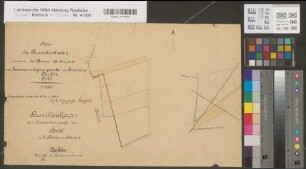
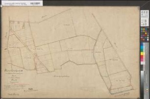
Soest (Soest), Separation Soest, Bl. 18 Brouillonkarte I (Sassendorf)
Soest (Soest), Separation Soest, Bl. 14 Brouillonkarte II Flur 22
Soest (Soest), Separation Soest, Bl. 3 Brouillonkarte I Flur 3
Soest (Soest), Separation Soest, Bl. 6 Brouillonkarte I Flur 6
Soest (Soest), Separation Soest, Bl. 19 Brouillonkarte II Flur 27
Soest (Soest), Separation Soest, Bl. 18 Brouillonkarte II Flur 26
Soest (Soest), Separation Soest, Übersichtskarte südliche Hälfte
Soest (Soest), Separation Soest, Übersichtskarte
Soest (Soest), Separation Soest, Übersichtskarte Stadt Soest
Soest (Soest), Separation Soest, Übersichtskarte Stadt Soest
Soest (Soest), Separation Soest, Übersichtskarte Stadt Soest
Soest (Soest), Separation Soest, Übersichtskarte Stadt Soest
Soest (Soest), Separation Soest, Bl. 18 Brouillonkarte I (Sassendorf)
Soest (Soest), Separation Soest, Bl. 14 Brouillonkarte II Flur 22
Soest (Soest), Separation Soest, Bl. 3 Brouillonkarte I Flur 3
Soest (Soest), Separation Soest, Bl. 6 Brouillonkarte I Flur 6
Soest (Soest), Separation Soest, Bl. 19 Brouillonkarte II Flur 27