- Location
-
Leibniz-Institut für Länderkunde e.V., Leipzig
- Collection
-
Collection Alphons Stübel
- Other number(s)
-
HK 1543 (Signatur)
- Material/Technique
-
kolor.
- Inscription/Labeling
-
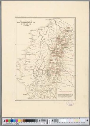
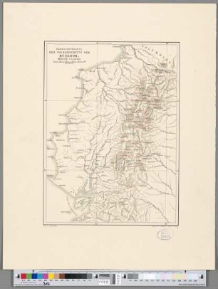
Maßstab in graph. Form (Kilometer). - Titel oberhalb des Kt.-Feldes. - Maßstab und Legende unten rechts. - Mit 1 Nebenkt.: Der Cerro Altar. - Mit Reiseroute. - Relief: Plastisch
- Subject (what)
-
Altkarte
Physische Karte
Vulkanismus
Gebirge
Ecuador
- Event
-
Veröffentlichung
- (where)
-
[S.l.]
- (when)
-
[nach 1903]
- Rights
-
Leibniz-Institut für Länderkunde e.V.
- Last update
-
12.12.2024, 10:15 AM CET
Data provider
This object is provided by:
Leibniz-Institut für Länderkunde e. V.. If you have any questions about the object, please contact the data provider.
Leibniz-Institut für Länderkunde e. V.. If you have any questions about the object, please contact the data provider.
Object type
- Karte
Time of origin
- [nach 1903]
Other Objects (12)
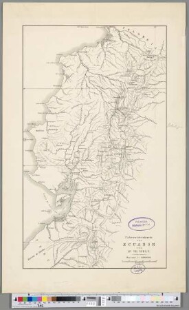
Übersichtskarte von Ecuador
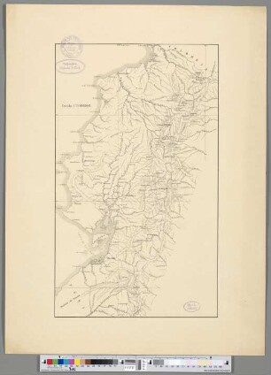
Übersichtskarte von Ecuador
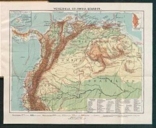
Venezuela, Colombia, Ecuador.
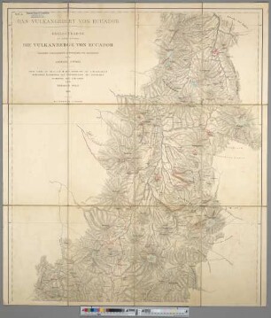
Das Vulkangebiet Von Ecuador : Begleitkarte Zu Dem Werke Die Vulkanberge Von Ecuador
Übersichtskarte Des Vulkangebiets Von Ecuador
Übersichtskarte Des Vulkangebiets Von Ecuador
Vulkane von Ecúador : Nördl. Blatt
Vulkane von Ecúador : Südliches Blatt
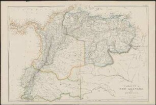
Venezuela, New Granada and Ecuador
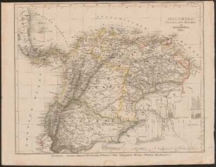
(Columbia) : Neu-Granada, Ecuador und Venezuela
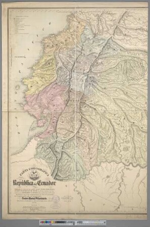
Carta Corográfica De La República del Ecuador
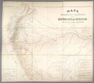
Mapa Geográfico-Histórico de la República del Ecuador
Übersichtskarte von Ecuador
Übersichtskarte von Ecuador
Venezuela, Colombia, Ecuador.
Das Vulkangebiet Von Ecuador : Begleitkarte Zu Dem Werke Die Vulkanberge Von Ecuador
Übersichtskarte Des Vulkangebiets Von Ecuador
Übersichtskarte Des Vulkangebiets Von Ecuador
Vulkane von Ecúador : Nördl. Blatt
Vulkane von Ecúador : Südliches Blatt
Venezuela, New Granada and Ecuador
(Columbia) : Neu-Granada, Ecuador und Venezuela
Carta Corográfica De La República del Ecuador