Landkarte
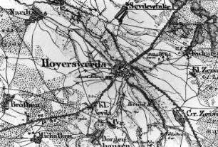
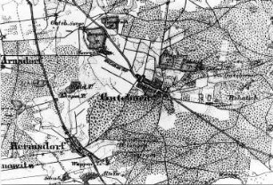
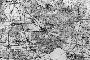
Hohenbocka. Topographische Karte vom Preußischen Staate, Bl. 250 Hoyerswerda, aufgen. 1846, Nachträge 1862
Negativ in schwarzweiß
- Alternative title
-
Mühlenarchiv Rapp - Karten (Serientitel)
- Other number(s)
-
df_rp-e_0140012 (Aufnahmenummer)
70516099 (Dokumentennummer)
- Material/Technique
-
Originalnegativ (Fotografie)
- Subject (where)
-
Hohenbocka (Standort)
- Event
-
Fotografische Aufnahme
- (who)
-
Rapp, Günter (Fotograf)
- Rights
-
Bitte beachten Sie die Nutzungsbedingungen der Deutschen Fotothek.
- Last update
-
2025-03-05T16:36:03+0100
Data provider
This object is provided by:
Deutsche Fotothek. If you have any questions about the object, please contact the data provider.
Deutsche Fotothek. If you have any questions about the object, please contact the data provider.
Object type
- Landkarte
Associated
- Rapp, Günter (Fotograf)
Other Objects (12)
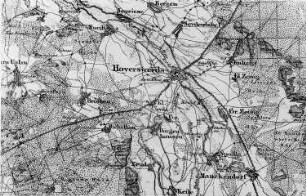
Hohenbocka. Topographische Karte vom Preußischen Staate, Bl. 250 Hoyerswerda, aufgen. 1846, Nachträgen 1862
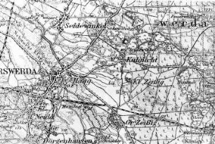
Hoyerswerda-Kühnicht. Topographische Karte vom Preußischen Staate, Blatt 250 Hoyerswerda, aufgen. 1846, Nachträge 1862
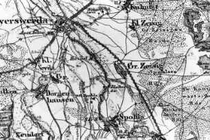
Hoyerswerda-Zeißig. Topographische Karte vom Preußischen Staate, Blatt 250 Hoyerswerda, aufgen. 1846, Nachträge 1862
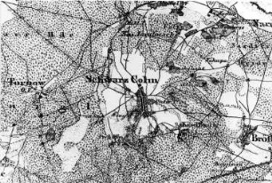
Hoyerswerda-Schwarzkollm. Topographische Karte vom Preußischen Staate, Bl. 250 Hoyerswerda, aufgen. 1846, Nachträge 1862
Hoyerswerda-Groß Neida. Topographische Karte vom Preußischen Staate, Bl. 250 Hoyerswerda, aufgen. 1846, Nachträge 1862
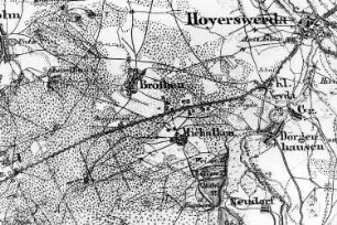
Hoyerswerda-Bröthen-Michalken. Topographische Karte vom Preußischen Staate, Bl. 250 Hoyerswerda, aufgen. 1846, Nachträge 1862
Guteborn. Topographische Karte vom Preußischen Staate, Bl. 250 Hoyerswerda, aufgen. 1846, Nachträge 1862

Ruhland. Topographische Karte vom Preußischen Staate, Bl. 250 Hoyerswerda, aufgen. 1846, Nachträge 1862
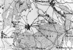
Lauta. Topographische Karte vom Preußischen Staate, Bl. 250 Hoyerswerda, aufgen. 1846, Nachträge 1862
Hermsdorf. Topographische Karte vom Preußischen Staate, Bl. 250 Hoyerswerda, aufgen. 1846, Nachträge 1862
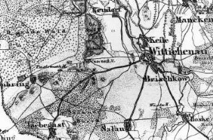
Wittichenau. Topographische Karte vom Preußischen Staate, Bl. 250 Hoyerswerda, aufgen. 1846, Nachträge 1862
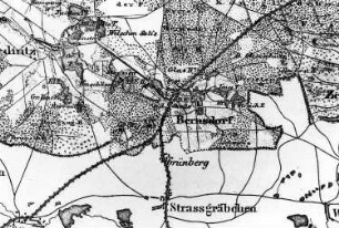
Bernsdorf. Topographische Karte vom Preußischen Staate, Bl. 250 Hoyerswerda, aufgen. 1846, Nachträge 1862
Hohenbocka. Topographische Karte vom Preußischen Staate, Bl. 250 Hoyerswerda, aufgen. 1846, Nachträgen 1862
Hoyerswerda-Kühnicht. Topographische Karte vom Preußischen Staate, Blatt 250 Hoyerswerda, aufgen. 1846, Nachträge 1862
Hoyerswerda-Zeißig. Topographische Karte vom Preußischen Staate, Blatt 250 Hoyerswerda, aufgen. 1846, Nachträge 1862
Hoyerswerda-Schwarzkollm. Topographische Karte vom Preußischen Staate, Bl. 250 Hoyerswerda, aufgen. 1846, Nachträge 1862
Hoyerswerda-Groß Neida. Topographische Karte vom Preußischen Staate, Bl. 250 Hoyerswerda, aufgen. 1846, Nachträge 1862
Hoyerswerda-Bröthen-Michalken. Topographische Karte vom Preußischen Staate, Bl. 250 Hoyerswerda, aufgen. 1846, Nachträge 1862
Guteborn. Topographische Karte vom Preußischen Staate, Bl. 250 Hoyerswerda, aufgen. 1846, Nachträge 1862
Ruhland. Topographische Karte vom Preußischen Staate, Bl. 250 Hoyerswerda, aufgen. 1846, Nachträge 1862
Lauta. Topographische Karte vom Preußischen Staate, Bl. 250 Hoyerswerda, aufgen. 1846, Nachträge 1862
Hermsdorf. Topographische Karte vom Preußischen Staate, Bl. 250 Hoyerswerda, aufgen. 1846, Nachträge 1862
Wittichenau. Topographische Karte vom Preußischen Staate, Bl. 250 Hoyerswerda, aufgen. 1846, Nachträge 1862