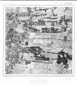
Luftbildpläne
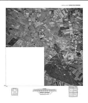
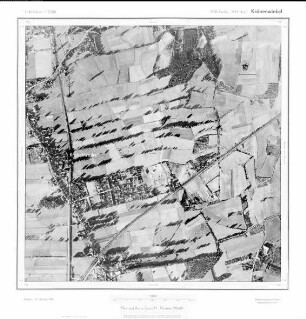
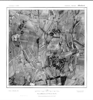
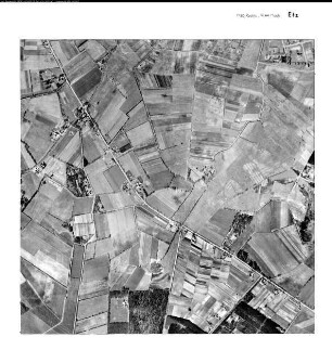
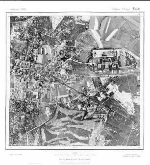
Hannover, Gauß-Krüger-Koordinaten: Rechtswert: 3550, Hochwert: 5804
- Reference number
-
RW 0230, 112
- Dimensions
-
Höhe: 60, Breite: 60, Maßstab: 1:5.000
- Context
-
Hansa Luftbild AG, Luftbildpläne 1951-1970 >> 6. Rechswerte beginnend mit 35 >> 6.27. 3550
- Holding
-
RW 0230 Hansa Luftbild AG, Luftbildpläne 1951-1970
- Provenance
-
Hansa Luftbild
- Date of creation
-
15.10.1951
- Other object pages
- Delivered via
- Zugangsbeschränkungen
-
Digitalisat vorhanden: Original für die Nutzung gesperrt. Digitalisat vorhanden
- Last update
-
07.03.2025, 10:20 AM CET
Data provider
This object is provided by:
Landesarchiv Nordrhein-Westfalen. Abteilung Rheinland. If you have any questions about the object, please contact the data provider.
Landesarchiv Nordrhein-Westfalen. Abteilung Rheinland. If you have any questions about the object, please contact the data provider.
Object type
- Luftbildpläne
Associated
- Hansa Luftbild
Time of origin
- 15.10.1951
Other Objects (12)
Gauß-Krüger-Koordinaten: Rechtswert: 3456, Hochwert: 5804
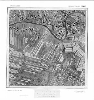
Cranz, Gauß-Krüger-Koordinaten: Rechtswert: 3550, Hochwert: 5932
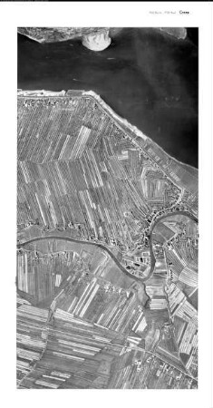
Cranz, Gauß-Krüger-Koordinaten: Rechtswert: 3550, Hochwert: 5932
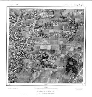
Langenhagen, Gauß-Krüger-Koordinaten: Rechtswert: 3550, Hochwert: 5812
Krähenwinkel, Gauß-Krüger-Koordinaten: Rechtswert: 3550, Hochwert: 5814
Altenhorst, Gauß-Krüger-Koordinaten: Rechtswert: 3550, Hochwert: 5816
Etz, Gauß-Krüger-Koordinaten: Rechtswert: 3550, Hochwert: 5944

Etz, Gauß-Krüger-Koordinaten: Rechtswert: 3550, Hochwert: 5944
Rissen, Gauß-Krüger-Koordinaten: Rechtswert: 3550, Hochwert: 5938
Langenhagen, Gauß-Krüger-Koordinaten: Rechtswert: 3550, Hochwert: 5812
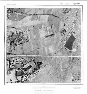
Langenforth, Gauß-Krüger-Koordinaten: Rechtswert: 3550, Hochwert: 5810

Hinterbrack, Gauß-Krüger-Koordinaten: Rechtswert: 3550, Hochwert: 5934
Gauß-Krüger-Koordinaten: Rechtswert: 3456, Hochwert: 5804
Cranz, Gauß-Krüger-Koordinaten: Rechtswert: 3550, Hochwert: 5932
Cranz, Gauß-Krüger-Koordinaten: Rechtswert: 3550, Hochwert: 5932
Langenhagen, Gauß-Krüger-Koordinaten: Rechtswert: 3550, Hochwert: 5812
Krähenwinkel, Gauß-Krüger-Koordinaten: Rechtswert: 3550, Hochwert: 5814
Altenhorst, Gauß-Krüger-Koordinaten: Rechtswert: 3550, Hochwert: 5816
Etz, Gauß-Krüger-Koordinaten: Rechtswert: 3550, Hochwert: 5944
Etz, Gauß-Krüger-Koordinaten: Rechtswert: 3550, Hochwert: 5944
Rissen, Gauß-Krüger-Koordinaten: Rechtswert: 3550, Hochwert: 5938
Langenhagen, Gauß-Krüger-Koordinaten: Rechtswert: 3550, Hochwert: 5812
Langenforth, Gauß-Krüger-Koordinaten: Rechtswert: 3550, Hochwert: 5810