Luftbildpläne
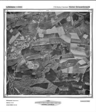
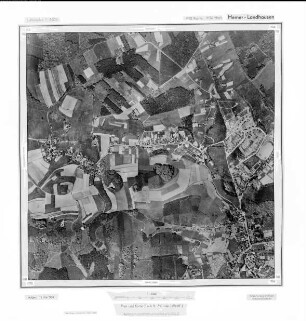
Hemer-Griesenbrauck, Gauß-Krüger-Koordinaten: Rechtswert: 3410, Hochwert: 5696
- Reference number
-
RW 0427, 1836
- Dimensions
-
Höhe: 60, Breite: 60, Maßstab: 1:10.000
- Context
-
Ministerium für Umwelt, Raumordnung und Landwirtschaft: Luftbildpläne >> 14. Nrn. 1759-1895
- Holding
-
RW 0427 Ministerium für Umwelt, Raumordnung und Landwirtschaft: Luftbildpläne
- Provenance
-
Ministerium für Umwelt, Raumordnung und Landwirtschaft
- Date of creation
-
1965
- Other object pages
- Delivered via
- Last update
-
07.03.2025, 10:32 AM CET
Data provider
This object is provided by:
Landesarchiv Nordrhein-Westfalen. Abteilung Rheinland. If you have any questions about the object, please contact the data provider.
Landesarchiv Nordrhein-Westfalen. Abteilung Rheinland. If you have any questions about the object, please contact the data provider.
Object type
- Luftbildpläne
Associated
- Ministerium für Umwelt, Raumordnung und Landwirtschaft
Time of origin
- 1965
Other Objects (12)
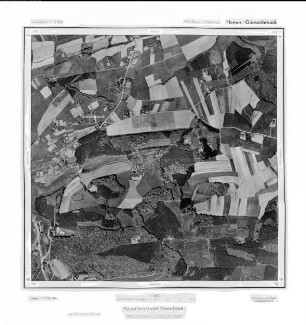
Hemer - Griesenbrauck, Gauß-Krüger-Koordinaten: Rechtswert: 3410, Hochwert: 5696

Hemer Griesenbrauck, Gauß-Krüger-Koordinaten: Rechtswert: 3410, Hochwert: 5696
Hemer-Griesenbrauck, Gauß-Krüger-Koordinaten: Rechtswert: 3410, Hochwert: 5696
Hemer - Griesenbrauck, Gauß-Krüger-Koordinaten: Rechtswert: 3410, Hochwert: 5696
Hemer Griesenbrauck, Gauß-Krüger-Koordinaten: Rechtswert: 3410, Hochwert: 5696
Barendorfer Sterbekasse VaG Hemer-Griesenbrauck, Hemer, Kreis Iserlohn
Hemer, Poststelle II Griesenbrauck über Schwerte, Nr. 43
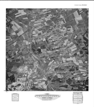
Hemer, Landhausen, Gauß-Krüger-Koordinaten: Rechtswert: 3412, Hochwert: 5696
Hemer, Landhausen, Gauß-Krüger-Koordinaten: Rechtswert: 3412, Hochwert: 5696
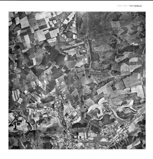
Hemer Landhausen, Gauß-Krüger-Koordinaten: Rechtswert: 3412, Hochwert: 5696
Hemer Landhausen, Gauß-Krüger-Koordinaten: Rechtswert: 3412, Hochwert: 5696
Hemer, Landhausen, Gauß-Krüger-Koordinaten: Rechtswert: 3412, Hochwert: 5696
Hemer - Griesenbrauck, Gauß-Krüger-Koordinaten: Rechtswert: 3410, Hochwert: 5696
Hemer Griesenbrauck, Gauß-Krüger-Koordinaten: Rechtswert: 3410, Hochwert: 5696
Hemer-Griesenbrauck, Gauß-Krüger-Koordinaten: Rechtswert: 3410, Hochwert: 5696
Hemer - Griesenbrauck, Gauß-Krüger-Koordinaten: Rechtswert: 3410, Hochwert: 5696
Hemer Griesenbrauck, Gauß-Krüger-Koordinaten: Rechtswert: 3410, Hochwert: 5696
Barendorfer Sterbekasse VaG Hemer-Griesenbrauck, Hemer, Kreis Iserlohn
Hemer, Poststelle II Griesenbrauck über Schwerte, Nr. 43
Hemer, Landhausen, Gauß-Krüger-Koordinaten: Rechtswert: 3412, Hochwert: 5696
Hemer, Landhausen, Gauß-Krüger-Koordinaten: Rechtswert: 3412, Hochwert: 5696
Hemer Landhausen, Gauß-Krüger-Koordinaten: Rechtswert: 3412, Hochwert: 5696
Hemer Landhausen, Gauß-Krüger-Koordinaten: Rechtswert: 3412, Hochwert: 5696
Hemer, Landhausen, Gauß-Krüger-Koordinaten: Rechtswert: 3412, Hochwert: 5696
Hemer - Griesenbrauck, Gauß-Krüger-Koordinaten: Rechtswert: 3410, Hochwert: 5696
Hemer Griesenbrauck, Gauß-Krüger-Koordinaten: Rechtswert: 3410, Hochwert: 5696
Hemer-Griesenbrauck, Gauß-Krüger-Koordinaten: Rechtswert: 3410, Hochwert: 5696
Hemer - Griesenbrauck, Gauß-Krüger-Koordinaten: Rechtswert: 3410, Hochwert: 5696
Hemer Griesenbrauck, Gauß-Krüger-Koordinaten: Rechtswert: 3410, Hochwert: 5696
Barendorfer Sterbekasse VaG Hemer-Griesenbrauck, Hemer, Kreis Iserlohn
Hemer, Poststelle II Griesenbrauck über Schwerte, Nr. 43
Hemer, Landhausen, Gauß-Krüger-Koordinaten: Rechtswert: 3412, Hochwert: 5696
Hemer, Landhausen, Gauß-Krüger-Koordinaten: Rechtswert: 3412, Hochwert: 5696
Hemer Landhausen, Gauß-Krüger-Koordinaten: Rechtswert: 3412, Hochwert: 5696
Hemer Landhausen, Gauß-Krüger-Koordinaten: Rechtswert: 3412, Hochwert: 5696