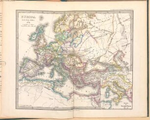
Karte
K. von Spruner's Historisch-Geographischer Schul-Atlas von Deutschland : zwölf colorirte Karten in Kupferstich

- Alternative title
-
Historisch-geographischer Schul-Atlas von Deutschland
- Location
-
Forschungsbibliothek Gotha -- SPA 2° 00614
- Extent
-
1 Bl., 20 S., 12 Bl., quer-4°
- Language
-
Deutsch
- Notes
-
Sammlung Perthes
- Creator
- Contributor
- Published
-
Gotha : Justus Perthes , 1866
- Sponsorship
-
Thüringen. Thüringer Staatskanzlei
- URN
-
urn:nbn:de:urmel-97e2a214-26a1-4611-bab6-2c3e4161a5935-00011128-019
- PURL
- Last update
-
14.04.2025, 12:54 PM CEST
Data provider
This object is provided by:
Forschungsbibliothek Gotha der Universität Erfurt. If you have any questions about the object, please contact the data provider.
Forschungsbibliothek Gotha der Universität Erfurt. If you have any questions about the object, please contact the data provider.
Object type
- Karte
Time of origin
- Gotha : Justus Perthes , 1866
Other Objects (12)
K. von Spruners Historisch-Geographischer Schul-Atlas : dreiundzwanzig kolorierte Karten in Kupferstich
K. von Spruner's Historisch-geographischer Schul-Atlas des Gesammtstaates Österreich von den ältesten bis auf die neuesten Zeiten : 13 illuminirte Karten in Kupferstich
Dr. K. von Spruner's Historisch-geographischer Schul-Atlas

Dr. K. von Spruner's Historisch-geographischer Hand-Atlas
Dr. K. von Spruner's Historisch-geographischer Schul-Atlas von Deutschland
Dr. K. von Spruner's Historisch-geographischer Schul-Atlas : dreiundzwanzig colorirte Karten in Kupferstich
Dr. K. von Spruner's Historisch-geographischer Schul-Atlas : dreiundzwanzig colorirte Karten in Kupferstich
K. von Spruners historisch-geographischer Schul-Atlas
Brief von Karl von Spruner an Maximilian Schmidt, o.D.
Karl von Spruner's historisch-geographischer Hand-Atlas, Abt. 1.. Atlas antiquus
![Vorbemerkungen zu K. von Spruner's historisch-geographischem Hand-Atlas : Atlas Antiquus ; [Erste Abteilung]](https://iiif.deutsche-digitale-bibliothek.de/image/2/df6a125a-8b28-4f84-a02c-ad445f1b841c/full/!306,450/0/default.jpg)
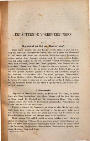
Vorbemerkungen zu K. von Spruner's historisch-geographischem Hand-Atlas : Atlas Antiquus ; [Erste Abteilung]
Tabellen der Weltgeschichte : (Zum Handgebrauch für S. M. König Max II.)
K. von Spruners Historisch-Geographischer Schul-Atlas : dreiundzwanzig kolorierte Karten in Kupferstich
K. von Spruner's Historisch-geographischer Schul-Atlas des Gesammtstaates Österreich von den ältesten bis auf die neuesten Zeiten : 13 illuminirte Karten in Kupferstich
Dr. K. von Spruner's Historisch-geographischer Schul-Atlas
Dr. K. von Spruner's Historisch-geographischer Hand-Atlas
Dr. K. von Spruner's Historisch-geographischer Schul-Atlas von Deutschland
Dr. K. von Spruner's Historisch-geographischer Schul-Atlas : dreiundzwanzig colorirte Karten in Kupferstich
Dr. K. von Spruner's Historisch-geographischer Schul-Atlas : dreiundzwanzig colorirte Karten in Kupferstich
K. von Spruners historisch-geographischer Schul-Atlas
Brief von Karl von Spruner an Maximilian Schmidt, o.D.
Karl von Spruner's historisch-geographischer Hand-Atlas, Abt. 1.. Atlas antiquus
Vorbemerkungen zu K. von Spruner's historisch-geographischem Hand-Atlas : Atlas Antiquus ; [Erste Abteilung]