Karten / Pläne
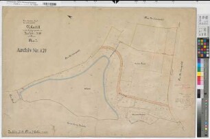
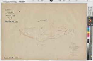
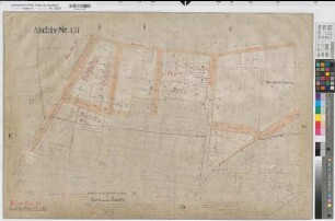
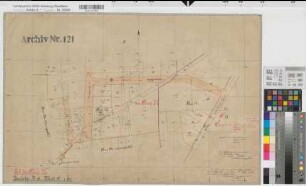
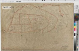
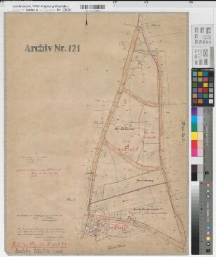
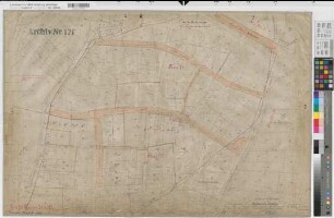
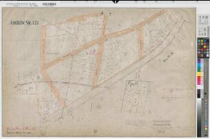
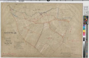
Iserlohn (Iserlohn), Calle (Iserlohn), Umlegung Iserlohn, Bl.5 Urkarte (Flur 5;6;15)
- Reference number
-
W 051, 33601
- Dimensions
-
Höhe: 67, Breite: 99, Maßstab: 1:1000
- Context
-
Karten A (Allgemein) >> 11. Landesamt für Agrarordnung >> 11.2215. Iserlohn (Iserlohn), Calle (Iserlohn), Umlegung Iserlohn
- Holding
-
W 051 Karten A (Allgemein)
- Date of creation
-
1922
- Other object pages
- Delivered via
- Last update
-
07.09.2027, 6:15 PM CEST
Data provider
This object is provided by:
Landesarchiv Nordrhein-Westfalen. Abteilung Westfalen. If you have any questions about the object, please contact the data provider.
Landesarchiv Nordrhein-Westfalen. Abteilung Westfalen. If you have any questions about the object, please contact the data provider.
Object type
- Karten / Pläne
Time of origin
- 1922
Other Objects (12)
Iserlohn (Iserlohn), Calle (Iserlohn), Umlegung Iserlohn, Urkarte II Calle Flur 7
Iserlohn (Iserlohn), Calle (Iserlohn), Umlegung Iserlohn, Urkarte II Calle Flur 8
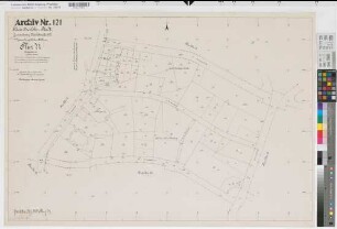
Iserlohn (Iserlohn), Calle (Iserlohn), Umlegung Iserlohn, Bl.13 Urkarte (Flur 15)
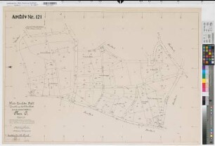
Iserlohn (Iserlohn), Calle (Iserlohn), Umlegung Iserlohn, Bl.12 Urkarte (Flur 72)
Iserlohn (Iserlohn), Calle (Iserlohn), Umlegung Iserlohn, Bl.9 Urkarte (Flur 15)
Iserlohn (Iserlohn), Calle (Iserlohn), Umlegung Iserlohn, Bl.4 Urkarte (Flur 6;71)
Iserlohn (Iserlohn), Calle (Iserlohn), Umlegung Iserlohn, Bl.8 Urkarte (Flur 71;72)
Iserlohn (Iserlohn), Calle (Iserlohn), Umlegung Iserlohn, Bl.14 Urkarte (Flur 15;50)
Iserlohn (Iserlohn), Calle (Iserlohn), Umlegung Iserlohn, Bl.3 Urkarte (Flur 4;6)
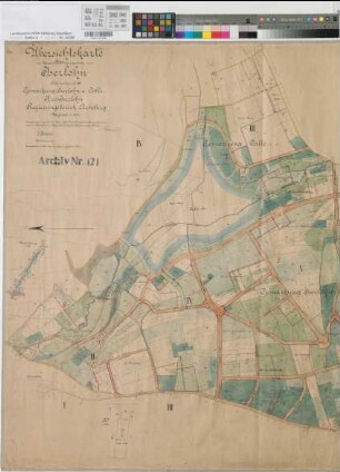
Iserlohn (Iserlohn), Calle (Iserlohn), Umlegung Iserlohn, Übersichtskarte
Iserlohn (Iserlohn), Calle (Iserlohn), Umlegung Iserlohn, Reinkarte Flur 71
Iserlohn (Iserlohn), Calle (Iserlohn), Umlegung Iserlohn, Reinkarte Flur 6
Iserlohn (Iserlohn), Calle (Iserlohn), Umlegung Iserlohn, Urkarte II Calle Flur 7
Iserlohn (Iserlohn), Calle (Iserlohn), Umlegung Iserlohn, Urkarte II Calle Flur 8
Iserlohn (Iserlohn), Calle (Iserlohn), Umlegung Iserlohn, Bl.13 Urkarte (Flur 15)
Iserlohn (Iserlohn), Calle (Iserlohn), Umlegung Iserlohn, Bl.12 Urkarte (Flur 72)
Iserlohn (Iserlohn), Calle (Iserlohn), Umlegung Iserlohn, Bl.9 Urkarte (Flur 15)
Iserlohn (Iserlohn), Calle (Iserlohn), Umlegung Iserlohn, Bl.4 Urkarte (Flur 6;71)
Iserlohn (Iserlohn), Calle (Iserlohn), Umlegung Iserlohn, Bl.8 Urkarte (Flur 71;72)
Iserlohn (Iserlohn), Calle (Iserlohn), Umlegung Iserlohn, Bl.14 Urkarte (Flur 15;50)
Iserlohn (Iserlohn), Calle (Iserlohn), Umlegung Iserlohn, Bl.3 Urkarte (Flur 4;6)
Iserlohn (Iserlohn), Calle (Iserlohn), Umlegung Iserlohn, Übersichtskarte
Iserlohn (Iserlohn), Calle (Iserlohn), Umlegung Iserlohn, Reinkarte Flur 71