Karten / Pläne
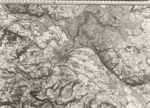
Münster und Umgebung, Atlas mit topographischen Karten (16 Blatt)
- Reference number
-
W 051, 47587
- Dimensions
-
Höhe: 35, Breite: 31, Maßstab: 1:20.000
- Further information
-
Ort: Münster
- Context
-
Karten A (Allgemein) >> 1. Topographische Karte, Übersichtskarten >> 1.1. Geographische, topographische Karten
- Holding
-
W 051 Karten A (Allgemein)
- Indexentry place
-
Münster
- Creator
-
Drucker: , Coppenrath´sche Buch- und Kunst-Handlung
- Provenance
-
Sammlungsregistraturbildner
- Date of creation
-
1869, 1870
- Other object pages
- Delivered via
- Last update
-
07.03.2025, 9:50 AM CET
Data provider
This object is provided by:
Landesarchiv Nordrhein-Westfalen. Abteilung Westfalen. If you have any questions about the object, please contact the data provider.
Landesarchiv Nordrhein-Westfalen. Abteilung Westfalen. If you have any questions about the object, please contact the data provider.
Object type
- Karten / Pläne
Associated
- Drucker: , Coppenrath´sche Buch- und Kunst-Handlung
- Sammlungsregistraturbildner
Time of origin
- 1869, 1870
Other Objects (12)

Münster und Umgebung,. topographische Karte
Topographische Karte Münster
Topographische Karte Münster (Westf.)
Topographische Karte 4011 Münster
Karten: Topographischer Atlas von Bayern, Bund IV
Karten: Topographischer Atlas von Bayern, Bund V
Verlag und Verschluss topographischer Atlanten und Karten
"Topographischer Atlas Niedersachsen und Bremen." 111 Karten
Topographische Karte C 4310 Münster
Topographischer Atlas des Königreichs Sachsen. Dresden und Umgebung
Topographische Karten Berlin und Umgebung
Topographische Karte Duisburg und Umgebung
Münster und Umgebung,. topographische Karte
Topographische Karte Münster
Topographische Karte Münster (Westf.)
Topographische Karte 4011 Münster
Karten: Topographischer Atlas von Bayern, Bund IV
Karten: Topographischer Atlas von Bayern, Bund V
Verlag und Verschluss topographischer Atlanten und Karten
"Topographischer Atlas Niedersachsen und Bremen." 111 Karten
Topographische Karte C 4310 Münster
Topographischer Atlas des Königreichs Sachsen. Dresden und Umgebung
Topographische Karten Berlin und Umgebung