Historisch-Politische Karte
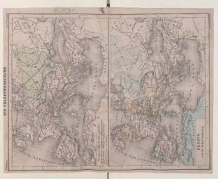
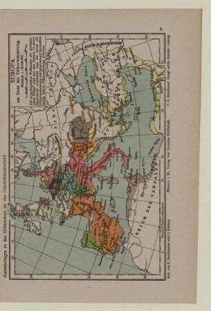
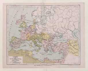
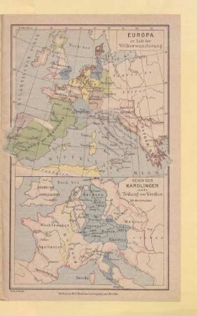
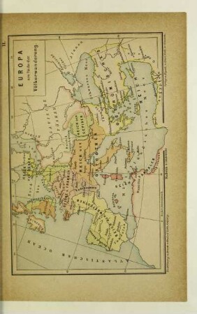
Geographisch-Historischer Atlas von Europa: Karte von Europa am Schlusse der Völkerwanderung. Mit einer Nebenkarte: Imperium Romanum anno 395
- Alternative title
-
KARTE VON EUROPA AM SCHLUSSE DER VÖLKERWANDERUNG / mit der historischen Uebersicht vom J. 1 - 500 n. Ch., der Andeutung der Theilung des römischen Reiches und der Skizze der Züge der Hauptvölker bis zu ihrer bleibenden Niederlassung in Europa; der Jugend gewidmet von C. Desjardins.
- Location
-
Deutsches Historisches Museum, Berlin
- Inventory number
-
Do 2006/815.8
- Measurements
-
Höhe x Breite: 49 x 67,5 cm (Blatt)
Höhe x Breite: 28,5 x 37 cm (Karte)
- Material/Technique
-
Papier, Lithographie, koloriert
- Classification
-
Kartografie (Gattung)
- Subject (what)
-
Europa
Antike
- Event
-
Herstellung
- (who)
-
Geograph, Kartograf: Constant Desjardins
Historiker, Topograph, Ethnograph: Joseph Vincenz Häufler
Kunsthandlung: Kunsthandlung H. F. Müller
- (where)
-
Wien, Österreich
- (when)
-
1838
- Rights
-
Deutsches Historisches Museum
- Last update
-
24.03.2023, 9:28 AM CET
Data provider
This object is provided by:
Stiftung Deutsches Historisches Museum. If you have any questions about the object, please contact the data provider.
Stiftung Deutsches Historisches Museum. If you have any questions about the object, please contact the data provider.
Object type
- Historisch-Politische Karte
Associated
- Geograph, Kartograf: Constant Desjardins
- Historiker, Topograph, Ethnograph: Joseph Vincenz Häufler
- Kunsthandlung: Kunsthandlung H. F. Müller
Time of origin
- 1838
Other Objects (12)
Die Völkerwanderung / Europa nach der Völkerwanderung
![Kriegsschauplätze Europas : [Nebst] 1 Nebenkarte](/assets/placeholder/searchResultMediaNoDigitisedMedia.png)
Kriegsschauplätze Europas : [Nebst] 1 Nebenkarte
Nr. 1 Die Völkerwanderung. Europa nach der Völkerwanderung
Das Imperium und die Völkerwanderung
Europa zur Zeit der Völkerwanderung
Die Völkerwanderung : Europa in Aufruhr
Sturm über Europa : die Völkerwanderung
Europa am Ende der Völkerwanderung
Europa am Ende der Völkerwanderung
Europa zur Zeit der Völkerwanderung.
Europa am Ende der Völkerwanderung
Europa am Ende der Völkerwanderung
Die Völkerwanderung / Europa nach der Völkerwanderung
Kriegsschauplätze Europas : [Nebst] 1 Nebenkarte
Nr. 1 Die Völkerwanderung. Europa nach der Völkerwanderung
Das Imperium und die Völkerwanderung
Europa zur Zeit der Völkerwanderung
Die Völkerwanderung : Europa in Aufruhr
Sturm über Europa : die Völkerwanderung
Europa am Ende der Völkerwanderung
Europa am Ende der Völkerwanderung
Europa zur Zeit der Völkerwanderung.
Europa am Ende der Völkerwanderung