- Reference number
-
Stadtarchiv Worms, 315, M03271
- Dimensions
-
Format: 9/12
- Further information
-
Rechte: Stadt Worms
Fotogr. Verfahren: Repro
- Context
-
315 - M- Großformataufnahmen
- Holding
-
315 - M- Großformataufnahmen
- Provenance
-
auch Aus F. W. Putzgers, Historischer Schulatlas: Europakarte nach 526?
- Date of creation
-
23. Juni 1948
- Other object pages
- Last update
-
15.12.2023, 3:52 PM CET
Data provider
This object is provided by:
Stadtarchiv Worms. If you have any questions about the object, please contact the data provider.
Stadtarchiv Worms. If you have any questions about the object, please contact the data provider.
Object type
- Archivale
Associated
- auch Aus F. W. Putzgers, Historischer Schulatlas: Europakarte nach 526?
Time of origin
- 23. Juni 1948
Other Objects (12)
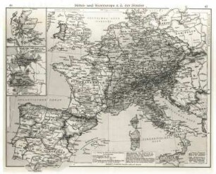
Mittel- und Westeuropa zur Zeit der Staufer
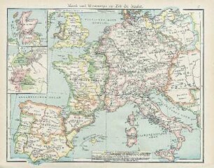
Mittel- und Westeuropa zur Zeit der Staufer

Karte von Mittel- und Westeuropa zur Zeit der Staufer
Kartenausschnitt, Neunkirchen
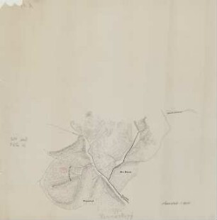
Kartenausschnitt Hermeskopf
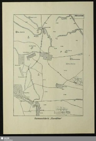
Kartenausschnitt „Chorostkow“
[Kartenausschnitt Münster]
[Kartenausschnitt Münster]
[Kartenausschnitt Münster]
Eiderkanal - Kartenausschnitt
Kartenausschnitt Nordfrankreich
[Kartenausschnitt Münster]
Mittel- und Westeuropa zur Zeit der Staufer
Mittel- und Westeuropa zur Zeit der Staufer
Karte von Mittel- und Westeuropa zur Zeit der Staufer
Kartenausschnitt, Neunkirchen
Kartenausschnitt Hermeskopf
Kartenausschnitt „Chorostkow“
[Kartenausschnitt Münster]
[Kartenausschnitt Münster]
[Kartenausschnitt Münster]
Eiderkanal - Kartenausschnitt
Kartenausschnitt Nordfrankreich