- Alternative title
-
A CHART OF THE ATLANTIC OCEAN I. SHEET
- Location
-
Deutsches Historisches Museum, Berlin
- Inventory number
-
Do 2006/1046
- Measurements
-
Höhe x Breite: 58 x 73,5 cm (Blatt)
Höhe x Breite: 47,3 x 62 cm (Karte)
Höhe x Breite: 50,5 x 65 cm (Platte)
- Material/Technique
-
Papier, Kupferstich
- Classification
-
Kartografie (Gattung)
- Subject (what)
-
Atlantischer Ozean
- Event
-
Herstellung
- (who)
-
Verleger: Robert Sayer
- (where)
-
London, Großbritannien und Nordirland
- (when)
-
20.02.1775
- Rights
-
Deutsches Historisches Museum
- Last update
-
24.03.2023, 9:28 AM CET
Data provider
This object is provided by:
Stiftung Deutsches Historisches Museum. If you have any questions about the object, please contact the data provider.
Stiftung Deutsches Historisches Museum. If you have any questions about the object, please contact the data provider.
Object type
- Seekarte
Associated
- Verleger: Robert Sayer
Time of origin
- 20.02.1775
Other Objects (12)
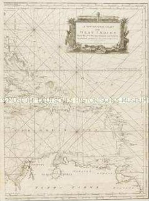
A new general Chart of the Westindies
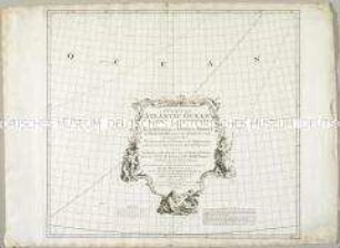
A Chart of the Atlantic Ocean
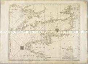
A Chart of the British Channel
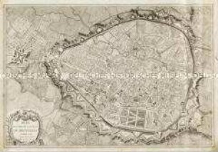
Plan routier de la Ville de Bruxelles
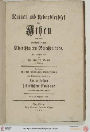
Ruinen und Ueberbleibsel von Athen nebst andern merkwuerdigen Alterthuemern Griechenlands

Hochzeitslager
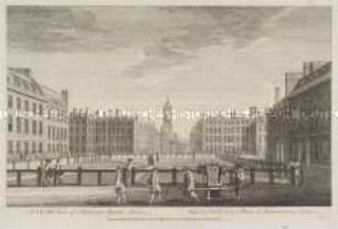
London, Hanover Square - aus einer Folge

An Index Map to the following Sixteen Sheets, being A Compleat Chart of the West Indies : With Letters in the Margin, to direct the placing the different Sheets in their proper Places
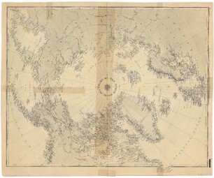
Chart of the North Polar Sea
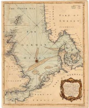
A Correct Chart of the German Ocean
![Plan von Brüssel, 1:4 500, Kupferstich, 1783 : Plan Routier De La Ville De Bruxelles. - [Ca. 1:4 500]. - London : R. Sayer ; Berlin : S. Schropp , 1783. - 1 Kt. : Kupferst. ; 74 x 50 cm ; W oben](https://iiif.deutsche-digitale-bibliothek.de/image/2/4b09c2bb-96ab-4949-83da-2a27d75e58b1/full/!306,450/0/default.jpg)
Plan von Brüssel, 1:4 500, Kupferstich, 1783 : Plan Routier De La Ville De Bruxelles. - [Ca. 1:4 500]. - London : R. Sayer ; Berlin : S. Schropp , 1783. - 1 Kt. : Kupferst. ; 74 x 50 cm ; W oben

Friedrich II., König von Preußen, 1776
A new general Chart of the Westindies
A Chart of the Atlantic Ocean
A Chart of the British Channel
Plan routier de la Ville de Bruxelles
Ruinen und Ueberbleibsel von Athen nebst andern merkwuerdigen Alterthuemern Griechenlands
Hochzeitslager
London, Hanover Square - aus einer Folge
An Index Map to the following Sixteen Sheets, being A Compleat Chart of the West Indies : With Letters in the Margin, to direct the placing the different Sheets in their proper Places
Chart of the North Polar Sea
A Correct Chart of the German Ocean
Plan von Brüssel, 1:4 500, Kupferstich, 1783 : Plan Routier De La Ville De Bruxelles. - [Ca. 1:4 500]. - London : R. Sayer ; Berlin : S. Schropp , 1783. - 1 Kt. : Kupferst. ; 74 x 50 cm ; W oben